Browser-based visualization tool for weather radar data
GAMIC Webview is a lightweight and powerful tool that enables a flexible and device-independent display of weather radar data in any web browser – desktop or mobile. It provides data from single radar sites up to multi-radar networks and serves data in real-time or archive mode.
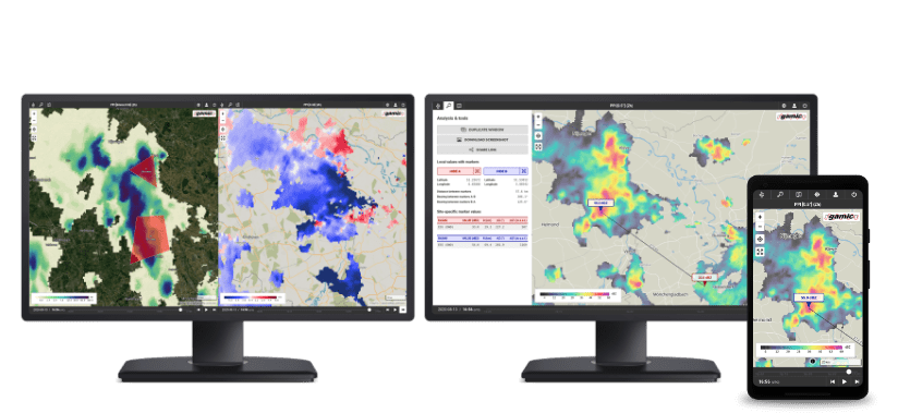
Comprehensive visualization and analysis
While providing an easy to use user interface, Webview comes with many useful features and tools for a comprehensive analysis of your weather radar data. Different products, for example PPIs and cross-sections of different moments, can be viewed side-by-side due to the built-in multi-window synchronization.
Also check out GAMIC Dashboard, a remote system health monitoring and data analysis web application.
Dynamic vector map underlay
To allow a detailed geographical assignment of weather radar data, Webview has an extensive vector map underlay based on OpenStreetMaps. The level of detail is set dynamically depending on the zoom level and map elements can be toggled as required by the user.
Webview comes with a basic background map but can be configured to display vector maps with various styles or even satellite image data. Both is possible by either using an optional external cloud map service or local map server. The latter solution can be set up for an internet-independent access.
Various application scenarios
Webview can be used everywhere. The only preconditions are an up-to-date web browser and network access. This allows various and flexible application scenarios, from in-office product monitoring to on-site data inspection and on-the-go weather checkup.
Webview setup

The final visualization in a client’s web browser is the core feature of GAMIC Webview. However, its basis is the Webview server which serves radar products from a central database. This is fed by the weather radar product generation on a Frog-Muran workstation. Instead a basic background map, vector maps or satellite underlays are possible with an optional external cloud map service. Another option is a local map server and can be set up to provide vector tiles for the underlay map which is thereby independent from internet access.